Jul 16-20

Past-E-Mail: Cam Notes - 2020: July: Jul 16-20
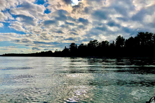
Calm Superior water    ...scroll down to share comments
Photo by Chad Johnson
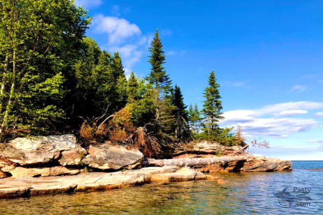
Large Shoreline Rocks    ...scroll down to share comments
Photo by Chad Johnson
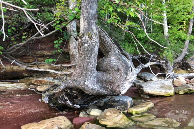
Interesting Roots    ...scroll down to share comments
Photo by Chad Johnson
Evening Kayak at Brunette Park    ...click to play video
See July 16 in the previous 22 years of the Pasty Cam
2019   2018   2017   2016   2015  
2014   2013   2012   2011   2010   2009  
2008   2007   2006   2005   2004  
2003   2002   2001   2000   1999   1998  

By
Mary Drew at Pasty Central (Mdrew) on Thursday, July 16, 2020 - 08:19 pm:

Chad Johnson went out to Brunette Park recently, for an evening kayak adventure and found Lake Superior fairly calm. What a relaxing paddle and a few interesting things spotted on the shoreline, including some huge rock, much different than the rock found on the Copper Harbor shoreline of Lake Superior.

The third photo is something that always amazes me, that a tree can grow and survive with the roots all exposed as this one has. Of course they don’t always survive and eventually end up toppling over into the Big Lake. It’s hard to sink roots in a sandstone shore and the wave action is brutal for these exposed shoreline trees.

Chad also made a video of the water’s movement and slowed down the motion. While watching it, I had the thought that it would be nice when out kayaking and the waves are picking up, to be able to slow them down to make paddling easier. If only...


By Uncle Chuck (Unclechuck) on Thursday, July 16, 2020 - 09:25 pm:

Great Pic's & Video! Can't wait to see it all
again! Talk to you all post op!!


By Deb S. (Usedtobeayooper) on Thursday, July 16, 2020 - 09:53 pm:

I love Brunette Park. My ex-in-laws had a cabin
about a mile down the road from there. We used to
walk in the water. It's just beautiful out there.
You'd better wear some swim shoes, though, because
the rocks are so slippery.


By D. A. (Midwested) on Thursday, July 16, 2020 - 10:55 pm:

Chad's second photo highlights that the sandstone structures so tall and beautiful in the Jacobsville area extend all the way to Bete Grise. They're just not a tall. I took the picture below about 1/2 mile due east of the north end of the Bete Grise beach. Part of the Keweenaw fault line runs almost directly below that house. You can easily see the lighter colored sandstone to the left and the darker volcanic basalt to the right.

Fault Line


By Alex "UP-Goldwinger" (Alex) on Friday, July 17, 2020 - 12:27 am:

Interesting timber, indeed.


By Deb S. (Usedtobeayooper) on Friday, July 17, 2020 - 08:20 am:

Very cool, D.A.


By George L. (Yooperinct) on Friday, July 17, 2020 - 09:32 am:

Me too, Uncle Chuck! Going in for total hip replacement Monday 7/20. Yep, CU post-op and best of luck on the procedure and your recovery.


By jbuck (Jbuck) on Friday, July 17, 2020 - 02:52 pm:

George L. (Yooperinct),
Praying all goes well with your surgery! With all the "improvements" to knees, hips, and hearts our Pasty Cammers will be in great shape by the end of the Summer. When you can, keep us posted on your progress guys!


By jbuck (Jbuck) on Friday, July 17, 2020 - 05:05 pm:

D. A. (Midwested),
Yikes! Doesn't look like a good option for a building site! But then, not all faults are the same.....


By D. A. (Midwested) on Friday, July 17, 2020 - 06:45 pm:

jbuck,

No chance of that happening anytime soon. The big rift that created both the Keweenaw and "simultaneously (in geologic time)" Isle Royale happened a little over one billion years ago. The map below shows the approximate major fault line running through the middle of the peninsula before extending into Lake Superior right where my photo demonstrates. It's part of a much bigger rift that continues down through Wisconsin, the middle of Iowa and into Kansas. Some say it almost ripped North America into two pieces. It continues underneath Lake Superior and then into the Lower Peninsula. Down there it is so much further underground it is not observable on the surface. But in the UP it was responsible for creating many of the great waterfalls we have. There are lots of other more minor fault lines.

Keweenaw Fault


By Alex "UP-Goldwinger" (Alex) on Friday, July 17, 2020 - 08:06 pm:

That's not my fault.


By jbuck (Jbuck) on Friday, July 17, 2020 - 09:49 pm:

Is this fault related to New Madrid or is it much older?


By D. A. (Midwested) on Friday, July 17, 2020 - 10:59 pm:

jbuck,

That's an interesting question. I've never studied the New Madrid area much. I'm sure Capt. Paul could answer more completely, accurately and authoritatively, but I'll take a shot. The Keweenaw rift (also often called the MidContinent Rift as label in the map) is quite a bit older than the geologic structures surrounding New Madrid.
New Madrid
The Grenville Mountains is labeling another big piece of what's now North America and is a tectonic plate (i.e. a big chuck of the earth's crust moving eastward, colliding with the more western crust. You can think of all the red MidContinent (or Keweenaw) Rift as a giant volcano except it's not the regular round shape but the giant inverted "U" shape. This map is trying to demonstrate how it puts pressure southward and eastward while the moving Grenville plate creates westward pressure. The New Madrid area is right in the middle of all this pressure so it's reacting kinda like popping a pimple (that's my own geologic term I just made up). It's newer and close to the surface so action is still going on today.


By D. A. (Midwested) on Friday, July 17, 2020 - 11:05 pm:

Here's the paper I got that map from. It has a lot of good info on the Lake Superior area where all the main volcanic action took place.


By FRNash/PHX, AZ (Frnash) on Friday, July 17, 2020 - 11:48 pm:

D. A. (Midwested)
"The Grenville Mountains is labeling another big piece of what's now North America and is a tectonic plate (i.e. a big chuck of the earth's crust moving eastward, colliding with the more western crust.
… while the moving Grenville plate creates westward pressure."


Eastie, westie, oopsie?


D. A. (Midwested)
"… it's reacting kinda like popping a pimple (that's my own geologic term I just made up)."


Ya just gotta love those fancy geological terms! 😉
By
D. A. (Midwested) on Saturday, July 18, 2020 - 03:19 am:

FRNash,
That's why I repeated myself. So I'd have 50/50 chance of getting one right. And added the map so you'd have something to use to check me.


By jbuck (Jbuck) on Sunday, July 19, 2020 - 08:40 pm:

Thanks D. A. (Midwested) - this is incredibly interesting! We are in the area where the activity of New Madrid is still felt.


By D. A. (Midwested) on Sunday, July 19, 2020 - 09:34 pm:

jbuck,

Here's a couple of technical papers about your area. I haven't read them yet but a quick scan told me the deep underlying structure is way older than the Keweenaw (1 billion years). It dates back to the oldest PreCambrain times of when the Earth first formed (4.6 billion years). The upper layers were the New Madrid fault is located is very new, just a few million years.

Tectonic development of the New Madrid seismic zone

General Geology of the Mississippi Embayment

I keep looking for Capt. Paul's name to pop up in my research. It has done so in the past.


Powered by:  
Join Today!
You are welcome to comment here or on 
Pasty Central's Facebook page
Here's a list of messages posted in the past 24 hours
See our guest photo gallery for more great views from the U.P.

Add a Message


A user/password combination is now required to post messages to Cam Notes. Registration is free. Click here to register or maintain your I.D.
Username:  
Password:

Home | Pasty Cam | Contest | Order Now | Bridge Cam | Past-E-Mail | GP Hall of Fame | Making Pasties | Questions