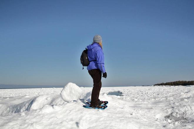
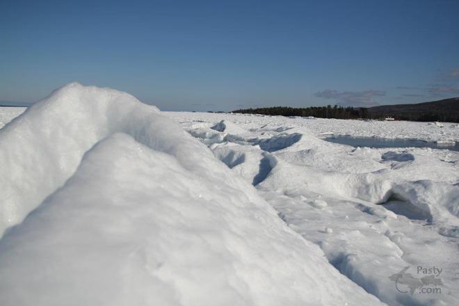
On Tuesday, we featured several "volcano" photos from the shores of Lake Superior, in the Marquette area and today, we're right out there on the ice with Melanie Hakala Rossi and friend, only this time in the Keweenaw. These two donned their snowshoes (or should I say "ice" shoes) and ventured out to climb the mounds and mountains of ice along Superior's shore. It's quite amazing that it builds up as high as these photos show it.
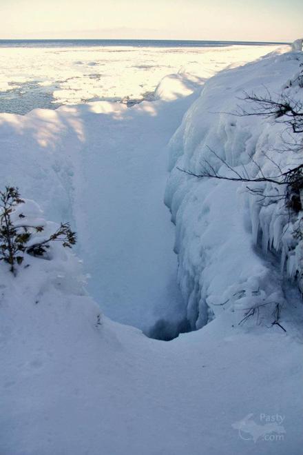
Melanie's last photo is something I've never seen in the winter, it's the Devil's Washtub, a few miles west of Copper Harbor. I guess this time of year, we should call it the Devil's ice bowl, instead. ;->
Once again, Gitche Gumee dons another disguise, keeping us enthralled by the mystery of how she'll look the next time we visit. Stay tuned...
By Deb S. (Usedtobeayooper) on Saturday, March 3, 2012 - 07:55 am:
Awesome photos! When I first tuned in, I thought for sure it would have to be Brenda on another one of her adventures. LOVED the Devil's Washtub!
By sometimesyooper (Nancyd) on Saturday, March 3, 2012 - 08:49 am:
Getting close to the old "wash tub" is tricky enough in the summer. It looks especially treacherous in the winter. Never seen it this time of year either. Thanks for the great pics. I wonder where the other shots were taken.
By Wes Scott (Travelnorth) on Saturday, March 3, 2012 - 01:28 pm:
Was the Devil's Bath tub created by wave action? This is a interesting formation I know nothing about. How far west of Copper Harbor? Past Hunter's Point?
By Donna (Donna) on Saturday, March 3, 2012 - 02:22 pm:
The Devil's Washtub...I have seen that thing a million times....and NEVER in the winter...wow...Excellent shots Mel!!!
I agree w/Deb...lol...I thought it was another one of Brenda's fabulous adventures!
5km west of Copper Harbor. Native copper vein in Lake Superior
By Capt. Paul (Eclogite) on Saturday, March 3, 2012 - 07:10 pm:
Believe it or not, I have never been to the Devil's Washtub, mostly because I don't know exactly where it is located along M26. If I had to guess looking at the summer time photos, it appears to be a weakness in the Copper Harbor Conglomerate (calcite vein, joint, etc...) that cut across the conglomerate. Later wave and water action has widened out the joint/vein to create the hole.
By Thomas Baird (Thomas) on Saturday, March 3, 2012 - 08:03 pm:
Nice Winter scenes. The climb every mountain pic sound like that song from The Sound of Music.
By osceola brulla (Sonofbrulla) on Saturday, March 3, 2012 - 09:26 pm:
summer 2012 is going to be so kool kind of like now :)))))))))))))))))
By Capt. Paul (Eclogite) on Saturday, March 3, 2012 - 09:33 pm:
By Helen in the U. P.! (Lahelo) on Saturday, March 3, 2012 - 04:30 pm: 5km west of Copper Harbor. Native copper vein in Lake Superior
I thought that reference looked familiar..... It's from the Mineralogy Database, a site I am heavily involved with these days.
Powered by:
Each day the Pasty Cam
has 2 areas to post messages:
Cam
Notes - comments related to today's picture and discussion
What'sUP
- other topics, conversation and announcements
***
Please use the appropriate forum *** Here's
a list of messages posted in the past 24
hours See our guest
photo gallery for more great views from the U.P.