May 18-07

Past-E-Mail: Cam Notes - 2007: May: May 18-07
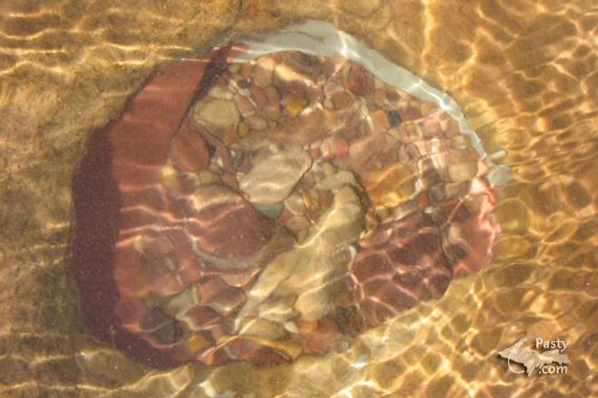
Hole in Superior?    ...scroll down to share comments
Photos by Brita Haapala
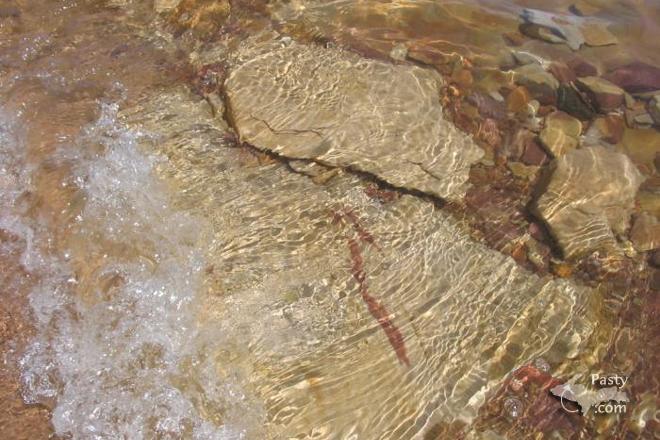
Sandstone waves    ...scroll down to share comments
Photos by Brita Haapala
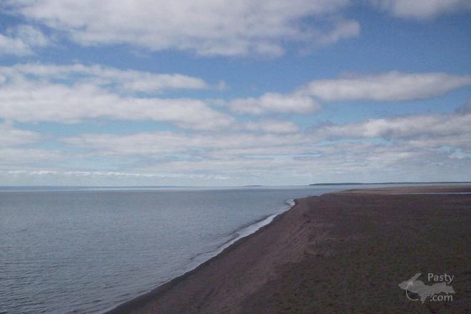
Gay Sands    ...scroll down to share comments
Photo by Rebecca Jennings


By
Mary Drew at Pasty Central (Mdrew) on Friday, May 18, 2007 - 05:08 am:

No matter what shoreline you visit along the vast miles of Lake Superior, you'll find different formationss of rocks and sand that make up her beaches and water's edge. Brita Haapala found this hole in the rock bed with smaller stones settled inside and along with her second photo, gives a perfect shot of the sandstone underneath the rolling waves. As for location of the first two pictures, my guess would be along the shores of Brunette Park, past the little town of Gay, which brings to mind the Gay Sands, seen here through the lens of Rebecca Jennings.


By joanne sherick (Shedoesnails) on Friday, May 18, 2007 - 06:49 am:

Good Morning all.


By Margaret, Amarillo TX (Margaret) on Friday, May 18, 2007 - 07:20 am:

The top one with all the different shades is interesting. Are they different rocks smooshed together or are they all the same rock?


By Deb S. (Usedtobeayooper) on Friday, May 18, 2007 - 07:34 am:

Any pictures of Superior are good!


By Paul A Rose (Whitewaves) on Friday, May 18, 2007 - 08:07 am:

YES...any pictures of Superior are just Great.


By Cindy Pihlaja Russell (Gone2long) on Friday, May 18, 2007 - 08:18 am:

LOL...I'm sure Cap'n Paul will have some technical, geological explanation for those "smooshed" rocks. I'm pretty sure "smooshed" is one of those scientific geological terms that he and Dr Nat use often in their teaching. :-D


By maija in Commerce Township (Maija) on Friday, May 18, 2007 - 09:04 am:

wonderful pictures, Brita.


By Dorothy Stewart (Bootjackbabe) on Friday, May 18, 2007 - 09:18 am:

More beautiful pictures to make my day.
Can't wait to get back to the Copper Country.
Two weeks and counting.!!!!!!
Loved the description of "smooshed" rocks---haven't heard that term in years.


By Brooke (Lovethekeweenaw) on Friday, May 18, 2007 - 10:16 am:

Ooh Rocks, I am partial to Lake Superior rocks. My son prefers to throw them back out into the lake.


By Dr. Nat (Drnat) on Friday, May 18, 2007 - 11:40 am:

As a matter of fact, I do use the term "smooshed" in class, but usually when I am lecturing about metamorphic rocks.

Over on the east side of the Keweenaw, the rocks are the Jacobsville Sandstone. The various colours you see in the sandstone have to do with the cement holding the little sand grains together. The holes you see developed in the rocks along the shoreline are actually called potholes and are formed as smaller rocks are swirled about by wave action, wearing down the rock beneath them.


By Erja from Finland (Erja) on Friday, May 18, 2007 - 11:45 am:

Tervehdys keväisestä Suomesta! Greetings from Finland! Any time of the year, Superior is just Great!!!


By Robert - CO (Halork) on Friday, May 18, 2007 - 12:22 pm:

WOW! I love the stones through the water pics.


By Anna Roehrich (Updreamer) on Friday, May 18, 2007 - 12:37 pm:

I have taken that same picture a number of times (the rocks through the water shot that is), but it never turns out quite as good as seeing it in real life...maybe because you can't hear the waves in a picture!

Brooke - I know what you mean about Lake Superior rocks...I have buckets of them...people think I'm nuts. The other night I dumped them all into the sink so I could see them wet...that always brings out their true beauty.


By Capt. Paul (Eclogite) on Friday, May 18, 2007 - 01:48 pm:

Are they different rocks smooshed together or are they all the same rock?

Actually, they are smooshed together; it looks like a conglomerate like what you would see around Calumet or along the north shore. The rocks in it look like the typical ones up there; basalts, rhyolites, and some epidotized rocks.

The real question is, how did it get there on the east side?? The closest rocks that look like that are next to the Fault (the basal conglomerates of the PLV), which isn't that far away, but too far to just "fall off" and land there. Quite possibly when the glaciers came it could have plucked out a piece from further north and deposited it in Oliver Bay. Or, it could just be post-glacial hominid activity.....


By gretchen arnold (Garnold) on Friday, May 18, 2007 - 05:39 pm:

I thought those rocks were from brunette park even before I read the message. That water is so clear, but cold!! We have a house in Gay and visit that park several times a year. We will be up the first week of June and can't wait. It is my most looked forward to week of the year, when my husband and I spend the week by ourselves, no one else allowed!


By Happy to be in the U.P. (Lahelo) on Friday, May 18, 2007 - 05:48 pm:

Capt. Paul (Eclogite), Thanks for the lesson Capt.Paul, I know I really appreciate the knowledge you have.

Brita and Rebecca thanks for the pictures they are sweet.


By kay Moore (Mskatie) on Friday, May 18, 2007 - 09:38 pm:

Wow the colors, the movement, the wetness. Fantabulous


Powered by:  
Join Today!
Each day the Pasty Cam has 2 areas to post messages: 
  • Cam Notes - comments related to today's picture and discussion
  • What'sUP - other topics, conversation and announcements
  • *** Please use the appropriate forum ***
    Here's a list of messages posted in the past 24 hours
    See our guest photo gallery for more great views from the U.P.

    Add a Message


    A user/password combination is now required to post messages to Cam Notes. Registration is free. Click here to register or maintain your I.D.
    Username:  
    Password:

    Home | Pasty Cam | Contest | Order Now | Bridge Cam | Past-E-Mail | GP Hall of Fame | Making Pasties | Questions