By Mary Drew at Pasty Central (Mdrew) on Monday, August 22, 2016 - 07:51 am:
I had a message from Capt. Paul (a.k.a Paul Brandes) the other day, with a whole slew of pictures taken on a little adventure he and Dr. Nat (a.k.a Nathalie Brandes) went on in the Huron Mountains. He also added his own commentary, which is way better than my retelling it, so here you go, Enjoy!
"Attached are a series of photos from our little adventure in the Huron Mountains across the Northwestern Rd between Big Bay and L’Anse and some photos of our new “toy”, a 2016 Jeep Wrangler HardRock edition. I will say that the photos do not do this road any justice as it is a very beautiful trip across. I figure it is about 20-22 miles across between the turn off on CR 510 in Marquette Co. (near the Eagle Mine) to Big Erick’s Bridge. As you’ll see from the photos, it is a 4x4 or ATV trail only! I would not recommend taking any sort of car or even “normal” SUV as you will not make it and help is a loooong ways off (cell phones don’t even work out there). I was surprised though that our Garmin GPS unit actually had the NW Rd. marked on the map which made it easy to follow. Still, I would not take anything less than a 4x4 with decent ground clearance. This is a road that I would LOVE to take in autumn when the leaves turn; I can imagine it is gorgeous! Below are a description of each photo:
Photo 1: The very beginning of the NW Rd. as you turn off CR 510.
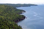
Photo 2: One of the many great vistas along the trail (as well as one of the few open areas)
Photo 3: Picking my path up one of the many washouts (and the reason one needs 4x4!) Nat is my spotter.
Photo 4: Just decided to go around everything instead.
Photo 5: A very typical view along the NW Rd.
Photo 6: A bridge marked “dangerous, do not cross”! Had Nat spot for me and crossed with no issues.
Photo 7: A very healthy beaver pond along the way.
Photo 8: Huron River at Big Erick’s Bridge.
Photo 9: A slightly muddy Jeep (and a very happy driver!)
Thanks for being our guide on the adventure!


 Printed on Recycled Internet
