Mar 18-05

Past-E-Mail: Cam Notes - 2005: March: Mar 18-05
Man-made mountain    ...scroll down to share comments
Photo by Tom Cook


By
Mary Drew at Pasty Central on Friday, March 18, 2005 - 06:58 am:

Mining in the U.P. is an integral part of the history of the region. This mountainous picture was captured by Tom Cook near Ishpeming and is part of the Tilden Mine operation in Marquette County. I'm not certain how many operating mines remain in this once mining rich part of the country, but this opencast iron mine is part of the Cleveland-Cliffs Iron Company. From what I understand you can take a tour of the operation which starts in Marquette at the office of the mining company and takes you through the intricacies of the only iron ore processing facility in the world with the capacity to produce both hematite and magnetite iron ore pellets. Hmm... that must be where the Ishpeming athletic teams derived their name: the Hematites!


By Dave,Laurium on Friday, March 18, 2005 - 06:59 am:

Good morning!!


By julie b., MI on Friday, March 18, 2005 - 07:02 am:

There are a lot of ghost stories about folks who lost their lives 'building' that mountain - and those who were warned by 'ghostly figures' as they were about to back their trucks too close to the edge.


By Roudy Mi on Friday, March 18, 2005 - 07:42 am:

I think that's the highest spot in Mich. Anyone confirm?


By Kathy from Whitmore Lake/Cheboygan on Friday, March 18, 2005 - 07:56 am:

Roudy, on my state of Michigan map, Mt. Curwood in Baraga County is the highest, but of course the map wouldn't track man-made features. Regardless, it's a dramatic picture.


By sur5er on Friday, March 18, 2005 - 08:06 am:

Wow!


By Missin the UP from NJ on Friday, March 18, 2005 - 08:07 am:

Whoa! That sure represents a lot of man hours!! How old is that 'mountain'?


By Cindy, St. Clair Shores, MI on Friday, March 18, 2005 - 08:27 am:

Good morning. I believe that Mt. Arvon in the Huron Mountains is the highest point in Michigan. What a neat picture! The geography of the U.P. is so interesting.

Glad to see you are back safely from your trip, Mary. I hope you brought signs of spring with you.


By FLYIN on Friday, March 18, 2005 - 08:34 am:

New saw that "mountain" before. Time for a road trip...I have flown over the mines near Marquette and they give you a perspective of what happens when economic and environmental objectives clash. Lots of tailings..........


By Capt. Paul in Nevada on Friday, March 18, 2005 - 08:48 am:

Mary: As far as I know, the only iron mines in operation around Ishpeming are the Empire and Tilden mines. The tour is a great way to see the mine and the processing plant up close. I think CC only runs the tour in the summer months though and only on certain days when activity is slow. Every year that Dr. Nat and I have been involved with Tech's TESI program we have taken the teachers on a tour of the facilities and they always say it's one of the highlights of their time up there.......


By Yooper in Westland on Friday, March 18, 2005 - 08:51 am:

The highest point (natural) in Michigan is Mt. Arvon with an elevation of 1979 feet.


By pungvait mi on Friday, March 18, 2005 - 08:56 am:

is this the same poor rock pile that can be seen when driving eastbound on us 41?


By Glenn ,Negaunee on Friday, March 18, 2005 - 09:38 am:

In the 1970,s I drove truck at the Tilden and had to back up and dump overburden near the edge of these dumps. One of my friends had the edge cave in on him but his truck hung on by its front wheels. This happened to him twice. There were a few other friends that weren't so lucky and were killed or disabled.


By Margaret, Amarillo TX on Friday, March 18, 2005 - 09:40 am:

Great pic regardless of how it got there.


By Marsha, Genesee/Aura on Friday, March 18, 2005 - 09:45 am:

Yup, Mt. Arvon is the highest. It's 11 inches taller than Mt. Curwood. I figure that if you own property on Mt. Curwood and want your mountain to be higher than the other, all you have to do is haul up a bag or two of soil & there you go! I've been to the top of Mt. Arvon. You can easily drive most of the way & then hike the rest fairly easily (even with my arthritis). At the top, you're in the forest, so you won't have a view.


By maijaMI on Friday, March 18, 2005 - 10:35 am:

It's not on 41. To see it first hand, take 35 south from 41 (at the edge of Marquette before Negaunee) to Gwinn. It is a beautiful drive in all seasons, particularly spectacular in fall when you come to Goose Lake. The overburden piles and huge equipment are really something to see first hand.


By Eric Simandl, Fabulous Las Vegas, NV on Friday, March 18, 2005 - 11:03 am:

I'm guessing that the shot is from Northbound M-35 between Suomi Location and Palmer.


By ric in WI on Friday, March 18, 2005 - 11:08 am:

...This is a GREAT photo...reminds one of Mt Shasta in Wash State...!


By JEFF PORTLAND OR on Friday, March 18, 2005 - 11:18 am:

LOOKS LIKE MT.ST HELENS BUT NO SMOKE COMING OUT


By Luke, Marquette on Friday, March 18, 2005 - 11:43 am:

I am pretty certain this is a waste rock pile from the Empire Mine, and not the Tilden. I've driven M-35 to the mine many times and that curve just before the pile is very familiar to me (plus the two signs on the left - the one sign is a directional to "Empire Mine Rd").

There are two remaining iron ore mines in the Marquette Iron Range now (Empire and Tilden), but they are now considered one operation. Cleveland Cliffs wanted to stream-line operations and cut costs. So now a lot of things are shared between the two facilites when before, they were competitors in the market. The company now generally calls the facility "Cliffs Michigan Mining Company," although many people will always remember them just as the Empire and Tilden Mines, managed by Cleveland Cliffs.


By ric in WI on Friday, March 18, 2005 - 11:45 am:

I drove past there just last week..I too believe it is the Empire Mine.....

ric in WI - email me please at:
mdrew@pasty.com.


By Marsha, Genesee/Aura on Friday, March 18, 2005 - 12:05 pm:

I'm assuming that when Mary Drew says this is near Ishpeming, she has first-hand information from the photographer. Always read her post under the picture! Maybe Tom Cook can add additional info or corroborate what she says.

Mary says: When preparing the pictures and notes for the daily feature, I use whatever information has been provided by the photographer in their gallery, then do a bit of research on the subject to elaborate. If the information isn't correct, that always spurns a good back and forth of where it actually is then! :->


By dh, now in MN on Friday, March 18, 2005 - 12:22 pm:

This is the rock pile visable driving eastbound US41 toward Ishpeming just as you pass Derocha's 41 Steakhouse. (Somewhere near the Humbolt--Ely area)

I think both the Tilden and Empire Mine use the same pile for waste rock.


By julie b., MI on Friday, March 18, 2005 - 12:51 pm:

Glenn, Negaunee:
Have you heard the stories about truck drivers who were 'warned' when they got too close to the edge? My friend from Palmer said she has heard them most of her life.


By Alex Tiensivu, Georgia on Friday, March 18, 2005 - 01:10 pm:

That is absolutely breath-taking! Guess what my new wallpaper picture is for today? :)


By j A P E i on Friday, March 18, 2005 - 01:36 pm:

Very good afternoon for every from here in FINLAND and Alahärmästä!

Minä latasin omalle koneelleni tuon muhkean vuorimaiseman taustakuvaksi - UPEA!

And now se english language; I charge (ramrod) my computers this grand mountain landscape my wallpaper - MAGNIFICENT!


By Ms. Katie, Tx. on Friday, March 18, 2005 - 01:59 pm:

Help...I've seen references to John Dee and George Hites? I'd like to find these and other sites r/t CC. Can you help with these sites.Thanks


By Audrey, San Jose, CA on Friday, March 18, 2005 - 02:12 pm:

Ms. Katie...

www.johndee.com


By Michnomad on Friday, March 18, 2005 - 02:12 pm:

I was just reading Superior Heartland by Fred Rydholm the other day. The book speculated that the Empire tallings pile is likely the highest spot in Michigan and that it may reach as high as 2200 feet above sea level in the future. Being as the book was written in 1989, makes one wonder how tall the tallings are now.


By Steve in IL on Friday, March 18, 2005 - 02:15 pm:

Ms. Katie-

Here is George Hite's: http://www.eagleharborweb.net/index.htm


By FRNash, PHX/AZ on Friday, March 18, 2005 - 02:20 pm:

Ms Katie
Here are some links:
John Dee's Snow Central
George Hite's Eagle Harbor Web


By Roudy Mi on Friday, March 18, 2005 - 02:59 pm:

http://www.msnbc.msn.com/id/7229424/
If the above works ,check it out. I've maintained this for years.


By SB, Ishpeming, MI on Friday, March 18, 2005 - 03:39 pm:

FYI: This is not the waste stock pile seen from US 41. That one is the North Dump Area 5 (top elevation) and is 178 feet short of the highest point in Michigan. It can't go any higher because it is man made and would require a permanent light for navigation. That area has not been used for at least 4 years and is a Tilden Mine product. It has been faced, seeded, fertilized and trees planted on the observable faces.
The waste stock pile in the photo is on Empire Mining Company property and also has not been used in a number of years. It is much lower in elevation than Area 5. No waste stockpiles are used jointly by both mining properties as each have their own and there are quite a few of them though only about seven are currently in use. I know of no one dying or being seriously injured on either of these two stockpiles.
I hope this clears up a few questions.


By Tom Cook on Friday, March 18, 2005 - 03:42 pm:

I apologize, any mistake is mine. Guess I don't know one from the other and I should have. This was taken just before Palmer coming from Marqutte way. Just wanted to give you all something to talk about. Hopefully they post another one of my pictures to debate about. Later

Thanks for the location specifics and the picture Tom! :->


By Michnomad on Friday, March 18, 2005 - 04:36 pm:

Thanks for the info SB. Even though it is not the tallest point in the state it is still is an impressive spot and hints at the importance of Marquette in the industrial development of our country


By Glenn, Negaunee on Friday, March 18, 2005 - 07:57 pm:

Julie B.
What do you mean by warned? Perhaps a divine sign from above? Nobody was killed or injured on this particular pile, which is on Empire Mine property, however other piles on Empire property have taken their toll. Drivers were warned not to back to the edge to dump. Sometimes there were cracks in the ground 20 feet or more from an edge.


By Chris and Ray, Grand Rapids, MI on Friday, March 18, 2005 - 08:00 pm:

Having taken the tour of the Tilden several times, I can honestly say that it should be on everyones UP must see list! It's incredible.


By ts on Friday, March 18, 2005 - 08:02 pm:

drove that road for 19 yrs working tilden--1 yr empire--10yrs at the mather -B-first 13 in the copper mines calumet


By Russ E. St. Clair county MI on Friday, March 18, 2005 - 09:24 pm:

Very impressive photo! First look at it I would have sworn it was out west! Must check that out when I'm up that way!
Anyhow was just checking my AAA map and was wondering if anyone else knew this--I didn't!-- When going north bound on I75, just after crossing into Roscommon county from Ogemaw county, on your left there is a big hill where the elevation is 1579'! Didn't realize anything that high that far south in MI!! Also, all you far SE trolls, did you know there is a MOUNTAIN in Macomb County? Don't laugh, check it out! It's at 34 Mile Rd. and Dequindre! Trombly Mtn. 1167' elevation! Not too shabby for otherwise flat farmlands!


By sur5er on Friday, March 18, 2005 - 09:44 pm:

Russ,

Are you sure that isn't Mount Trashmore? I know that back in the '80's they built a couple of ski hills out that way...out of trash.


By downstate don on Friday, March 18, 2005 - 09:51 pm:

Take the 35 route every year from US41 to Gwinn,
from Gwinn through the old air force base and
back roads to Munising and head back downstate.
Such a pleasant drive. Lots of winding roads and
small towns but a very scenic route.


By qrtrbrn on Friday, March 18, 2005 - 10:12 pm:

There are no ski hills in Macomb County


By BobT, Michigan on Friday, March 18, 2005 - 11:02 pm:

Russ E - That's the Ford Motor Company test track. The hill is actually called Twombly Mtn. and is their artifically built (partly) incline on the test circuit. Look it up on Topozone.com .
It is almost impossible to see from the surrounding roads as it is on private property. It is in the Bruce Hills, which rise from the flatter lake plain to the south and east of Romeo, Michigan. This area is also the peach and apple capital of SE Michigan.


By Russ E. St. Clair county MI on Friday, March 18, 2005 - 11:28 pm:

Trombly Mtn. as marked 1167 ft. on official Huron Clinton Metro maps is on the NE corner of Dequindre (the county line) and 34 Mile Rd, in Bruce Twp. It is in Ford Motor Co. Proving Ground Property. It has a radio tower on the top with a little maintainence shack next to it. I believe Ford used this "hill" to run up and downhill tests on their vehicles. It is now of late getting grown up with many trees on it. There are several "high" hills all around that area in Macomb, Oakland and Lapeer countys which Trombly is apparently the highest. These hills can be seen from M53 (Van Dyke) or coming from the east a long ways! I'm sure all these hills can't be man made. If Trombly is, it was done many, many years ago!(30s or 40s) There are many massive landfill type hills in SE MI but I've not seen any to compare to Trombly or anything like "up north"! Ski hills? I think not on that also. Lots of toboggan, sled hills etc. at parks. Lots of natural ski hills in Oakland county! We had some ski hills over here in St. Clair county but they were not on hills protruding UP from the terrain but rather on slopes going DOWN into the Black River Valley. Such is the case in many basically flat areas that do have ski hills.


By bobtiura on Saturday, March 19, 2005 - 12:02 am:

Bruce E - The Bruce Hills are glaciial deposits from the last great glacial period in North America. They rise above the old lake bottom and they have supported the aggregate industry in this area for many years. The deposits west of here, in Oakland County, just west of Dequindre Road, were heavier and were mined well into and toward the end of the twentieth century and into the twenty first. There are now many subdivisions built around many of these pits. I don't think there are any large landfills in this area, it doesn't have the clay bottom that most most landfills require. Maybe a few old dump sites from earlier years, but these were residential in nature and, hopefully, didn't contaminate the groundwater layers. Most of the area in the "hills" is very clean groundwater, which is why Romeo's city water is drawn from wells.


By Russ E. St. Clair county MI on Saturday, March 19, 2005 - 12:04 am:

Bob T-- Your posting beat mine on! We were over that way 1 or 2 years ago and yes it has grown up so much with trees, woods, new homes along the roads one can't see that hill very well anymore. The whole Ford Motor property is a virtual jungle of vegetation now along most of the fence line!
Back in the late 80s early 90s we used to be over that way often and it was wide open for visibility! Thanks for your input!


By Capt Paul in Nevada on Saturday, March 19, 2005 - 02:03 am:

For all that are interested, the highest incorporated city in Michigan is not in the UP, but is Cadillac at 1531 ft above sea level in the LP. The highest incorporated town in the US is Leadville, Colorado at 10,430 ft above sea level.


By Capt Paul in Nevada on Saturday, March 19, 2005 - 02:09 am:

Oops, the elevation for cadillac should be 1351 ft.

My mistake.................


By sur5er on Saturday, March 19, 2005 - 03:24 am:

Capt Paul,

Wow..I never would have guessed Cadillac. I would have guessed the Porcipine Mts. or Keweenaw.


By Les Moore out west on Saturday, March 19, 2005 - 07:28 pm:

Mount Shasta used to be in California.

Mount Rainier is still in Washington.

Mount hood is still in Oregon.


By FLEWTODAY on Saturday, March 19, 2005 - 07:45 pm:

Fly into Leadville, CO and they give you a certificate.......Highest airport in the lower 48....and you better watch your INDICATED airspeed or you might just land a little short.....Leadville sorts out the pilots from the aviators.........Fly over the Ford track at 34 mile regularly. Sometimes if you fly low, they pull the cars in as they think you might be some sort of journalistic spy........LOL


By Ken ja Mimi from da UP on Saturday, March 19, 2005 - 08:43 pm:

Didn't Donn DeYampert put a pic out of this same pile a coupla years ago? But from the south side?
Seems to me.....

by Donn de Yampert

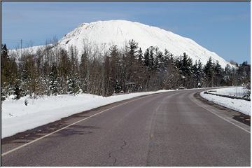
By
Jason Johnson (Tobaggans) on Thursday, November 5, 2009 - 11:40 pm:

I don't think the EPA will allow any mining company to build mountains like this anymore. Of course it would be awesome to build a mountain custom made for snowboarding, skiing, & toboggans.

Jason
Toboggan Lover


Powered by:  
Join Today!
Each day the Pasty Cam has 2 areas to post messages: 
  • Cam Notes - comments related to today's picture and discussion
  • What'sUP - other topics, conversation and announcements
  • *** Please use the appropriate forum ***
    Here's a list of messages posted in the past 24 hours
    See our guest photo gallery for more great views from the U.P.

    Add a Message


    A user/password combination is now required to post messages to Cam Notes. Registration is free. Click here to register or maintain your I.D.
    Username:  
    Password:

    Home | Pasty Cam | Contest | Order Now | Bridge Cam | Past-E-Mail | GP Hall of Fame | Making Pasties | Questions